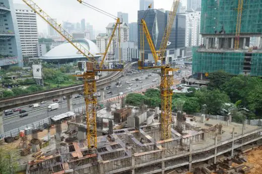
Unveiling the art of utility mapping for construction projects, Building site tips, Property contractor advice
Beyond Blueprints: Unveiling The Art Of Utility Mapping For Construction Projects
23 Aug 2023
Are you tired of dealing with unexpected utility issues that delay your construction projects? Look no further, because beyond the blueprints lies a powerful tool that can revolutionize the way you approach construction: utility mapping. In this article, we will unveil the art of utility mapping and explore its importance in ensuring safety, efficiency, and preventing damage and delays.
When it comes to construction projects, accurate knowledge of underground utilities is crucial for success. Utility mapping professionals are skilled in using advanced technology and techniques to map out these underground networks, revealing a hidden world beneath the surface. With their expertise, they can identify the precise locations of gas lines, water pipes, electrical cables, and more. By going beyond traditional blueprints and incorporating utility mapping into your construction process, you gain a clearer understanding of potential obstacles and can plan accordingly. This not only helps prevent costly delays but also ensures the safety of workers by avoiding accidental damages to these vital systems.
So why settle for uncertainty when it comes to your construction projects? Embrace the art of utility mapping and unlock a whole new level of efficiency and safety. In this article, we will delve deeper into the challenges faced by utility mapping professionals as well as explore how advanced technology plays a crucial role in achieving accurate maps. Get ready to discover how utility mapping goes beyond blueprints to empower your construction endeavors like never before!
The Importance of Utility Mapping in Construction Projects
Utility mapping is crucial in construction projects as it helps to uncover the hidden web of underground pipes and cables, ensuring that the project can proceed smoothly without any unexpected disruptions. By accurately mapping out the utilities beneath the ground, construction teams can avoid costly mistakes such as accidentally damaging water or gas lines during excavation. This not only saves time and money but also ensures the safety of both workers and nearby residents.
Additionally, utility mapping allows construction crews to plan their projects more efficiently. With a clear understanding of where all the utilities are located, they can avoid potential conflicts with existing infrastructure. For example, if a new building is being constructed in an area known to have underground power lines, proper utility mapping will help determine how to safely work around them. This level of precision and foresight minimizes delays and enables construction activities to progress smoothly, ultimately delivering projects on time and within budget.
Challenges Faced by Utility Mapping Professionals
Navigating the obstacles encountered by professionals in the field of utility mapping can be an intricate and demanding task. As a utility mapping professional, you are constantly faced with challenges that require problem-solving skills and attention to detail. Here are four common obstacles that you may encounter in your line of work:
- Inaccurate or outdated records: One of the biggest challenges in utility mapping is dealing with incomplete or incorrect information about the location and depth of underground utilities. This can lead to costly mistakes during construction projects.
- Complex urban environments: Urban areas are often packed with various utilities running underground, such as water pipes, gas lines, electrical cables, and more. Navigating through these dense networks requires expertise and precision to ensure accurate mapping.
- Access limitations: Sometimes, accessing certain areas for utility mapping can be difficult due to physical barriers like buildings or infrastructure. Limited access can hinder your ability to accurately map utilities in those areas.
- Time constraints: Construction projects usually have tight deadlines, leaving little time for thorough utility mapping. Balancing speed and accuracy becomes crucial to meet project timelines while ensuring precise data collection.
Overcoming these challenges requires a combination of technical knowledge, experience, and adaptability as a utility mapping professional. By staying updated on industry advancements and using advanced technologies like ground-penetrating radar (GPR) or LiDAR scanning systems, you can enhance your abilities to tackle these obstacles effectively.
Advanced Technology and Techniques for Accurate Mapping
By utilizing cutting-edge technology and innovative techniques, you can capture a detailed and accurate picture of underground infrastructure, like a skilled investigator uncovering hidden secrets. Advanced technology has revolutionized the field of utility mapping, allowing professionals to go beyond traditional blueprints and uncover valuable information that was previously inaccessible. One such technology is Ground Penetrating Radar (GPR), which uses electromagnetic waves to create a subsurface image. GPR can penetrate various materials, including soil, concrete, and asphalt, providing a comprehensive view of underground utilities. This non-destructive technique allows for real-time data collection without the need for excavation or disruption to the construction site.
Another advanced technique used in utility mapping is LiDAR (Light Detection and Ranging). LiDAR utilizes laser pulses to measure distances and create highly detailed 3D models of the surface terrain. By combining LiDAR data with other sources such as aerial imagery or GPS coordinates, utility mapping professionals can accurately map out the location and depth of underground infrastructure. This information is crucial for planning construction projects and avoiding costly accidents or delays caused by accidental utility strikes. Additionally, Geographic Information Systems (GIS) software plays a vital role in organizing and analyzing collected data. GIS integrates various data sources into one cohesive system, allowing professionals to visualize complex spatial relationships between different utilities.
To provide further depth on these advanced technologies and techniques for accurate mapping, here is a table showcasing their key features:
| Technology/Technique | Key Features |
| Ground Penetrating Radar (GPR) | – Non-destructive imaging |
- Real-time data collection
- Ability to penetrate various materials |
| LiDAR (Light Detection and Ranging) | – Highly detailed 3D modeling
- Accurate surface terrain measurements
- Integration with other data sources |
| Geographic Information Systems (GIS) | – Data integration from multiple sources
- Visualization of spatial relationships between utilities
- Analysis and decision-making support |
These advanced technologies and techniques offer a new level of precision and accuracy in utility mapping. By leveraging them, professionals can minimize risks, make informed decisions, and ensure the successful execution of construction projects.
Ensuring Safety and Efficiency in Construction Projects
To ensure a smooth and secure construction project, you need to prioritize safety and efficiency. Safety should always be the topmost concern in any construction endeavor. By implementing strict safety protocols and providing proper training to all workers, you can minimize the risk of accidents and injuries on-site.
This includes regular inspections of equipment, ensuring that all workers are wearing appropriate protective gear, and maintaining a clean and organized work environment. Additionally, it is crucial to have emergency response plans in place to address any unforeseen situations promptly.
Efficiency is equally important in construction projects as it directly impacts productivity and cost-effectiveness. Streamlining processes and utilizing advanced technology can significantly improve efficiency on-site. This may involve using drones for aerial surveys or employing 3D modeling software for accurate measurements and planning. By embracing these innovative techniques, you can eliminate guesswork, reduce errors, and complete tasks more efficiently.
Additionally, effective communication among team members is vital for smooth coordination throughout the project. Regular meetings and clear channels of communication help ensure that everyone is working towards common goals while minimizing delays or misunderstandings. Ultimately, by prioritizing safety and efficiency in your construction projects, you can achieve successful outcomes while keeping both your workers and the overall project secure.
The Role of Utility Mapping in Preventing Damage and Delays
Maximize the efficiency and safety of your construction endeavors by incorporating utility mapping techniques, which provide comprehensive information about underground utilities to prevent potential damage and delays. Underground utilities such as gas pipelines, water mains, electrical lines, and telecommunications cables are crucial for the functioning of a modern society. However, their location is often unknown or inaccurately marked on blueprints, leading to costly mistakes during construction. Utility mapping utilizes advanced technologies such as ground-penetrating radar (GPR) and electromagnetic induction to accurately locate and map underground utilities. By investing in utility mapping services before starting a construction project, you can avoid accidental damage to these vital infrastructure networks, minimizing costly repairs and project delays.
In addition to preventing damage, utility mapping also plays a crucial role in ensuring project efficiency. With accurate information about the location and depth of underground utilities, construction teams can plan their work more effectively. They can identify potential conflicts or clashes between planned excavations and existing utilities early on, allowing them to make necessary adjustments before any work begins.
This proactive approach helps streamline the construction process by reducing unexpected interruptions or setbacks that may occur due to accidental utility strikes. By incorporating utility mapping into your construction projects, you not only enhance safety but also optimize productivity by avoiding unnecessary disruptions caused by damaged utilities.
Unveiling the art of utility mapping for construction projects Conclusion
So there you have it, the art of utility mapping is a crucial aspect of construction projects. It plays a vital role in ensuring safety and efficiency by accurately locating underground utilities and identifying potential hazards.
Despite the challenges faced by utility mapping professionals, advanced technology and techniques have emerged to enhance accuracy and speed up the mapping process. By preventing damage to existing utilities and avoiding delays caused by unexpected encounters, utility mapping helps construction projects run smoothly and on schedule. So next time you embark on a construction project, remember the importance of utility mapping beyond blueprints.
Comments on this Unveiling the art of utility mapping for construction projects article are welcome.
Construction
Construction Safety Posts
Construction Site Equipment Every Contractor Needs

Why Construction Safety Is Important
Best practices to improve construction site safety
Safety rules and responsibilities for construction sites
Building Design
Architecture
Comments / photos for the Unveiling the art of utility mapping for construction projects page welcome


