How to detect underground utilities tips, Building Excavating Mapping, Radio Frequency Cable Locators, Property Services Guide
How To Detect Underground Utilities
post updated 11 February 2024
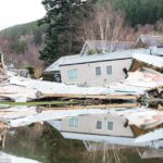
When starting a new building or excavating project, it is essential that work to detect any underground utility mapping is undertaken before the project begins.
8 July 2020
What are underground utilities?
This can include pipes, lines, cables and other services that are buried underground at your home. Just beneath the surface, there are so many different systems, which are used to provide your communications, gas, electricity, water, and sewage services and it is important that these not be damaged in the construction process.
Hitting an electric line could result in workers being electrocuted, hitting a gas line could result in release of natural gases, hitting a telecommunications line could result in faulty services from your provider. On top of all that, failing to search for underground utilities can lead to: liability issues, project delays, costly repairs, and contractor fines, just to name a few consequences.
The issues are varied, but it is clear that finding a way to locate and map all of these different subterranean networks is vital to the success and safety of any project. Metal detecting is such a fascinating hobby – being a detectorist is one of those things that more you do it, the more you want to do it.
When it comes to detecting underground utilities, using a utility locator is essential for safety and efficiency. A utility locator is a specialized tool designed to find hidden pipes, cables, and other underground infrastructure.
What Detection Methods are there?
A variety of scanning and avoidance tools are available for detecting utilities, each with unique strengths and weaknesses. It is important to look at how invasive each type is, what types of materials it can detect, as well as the breadth and depth of its detection capabilities.
Ground Penetrating Radar and Electromagnetic Location are the most common tools, but other methods may include:
- Frequency Locators
- Magnetometers
- Cable Locators
- Acoustic Pipe Location
- Potholing (Hydro/Vacuum Excavation)
So let’s dive in to what each one does.
Ground Penetrating Radar
This method of using radar pulses to map the layout below ground is non-destructive as it requires no digging to undertake. GPR surveys can help identify: clay, plastic, PVC, metal, gas/power lines, water and wastewater systems, fiber optics, septic tanks, and more, working with the non-metallic and non-conductive materials that are difficult to locate through traditional methods.
A two-dimensional image of the subsurface is created through this method, which allows workers to understand the underground layout. GPR may not be the best choice if it is difficult to move the system over the ground in a smooth fashion or it is too far from the ground surface. Certain materials such as clay soils or areas where a great deal of de-icing salts have been used may also negatively affect the signal.
Electromagnetic Profiling Locator
Consists of a transmitter and receiver to locate conductive materials underground. However, this method works best for conductive and metallic detection and struggles with other materials such as plastic, terra cotta, or asbestos. This method is particularly efficient at picking up gas, electric, water, sewage and various other utility lines.
This method is often used to quickly narrow a search area for utilities as it used electromagnetic waves to profile the conductivity and resistivity of the ground and develop a basic map of area based on that.
Radio Frequency & Cable Locators
Can be useful for fibre optic, phone lines, and electric lines by detecting energy generated by the buried lines. These detect not only the presence but also the proximity of buried cables and is most effective for electric and phone cables. The frequencies are either inductive through tools such as a ring clamp or conductive through direct connection to the pipe.
Induction is used when it is not possible to access the targeted line from the surface, however it is not as precise as the direct method, which is preferred whenever possible.
How To Detect Underground Utilities – Magnetometers
This method can more easily access areas that the GPR would not work in such as woods or uneven surfaces and can typically detect utilities that are buried deeper in the ground than other methods will reach.
However, it only works with ferrous metals, so certain types such as aluminium, brass, and copper cannot be detected with this method. Additionally, areas with many metallic objects nearby can result in signal interference.
How To Detect Underground Utilities – Acoustic Pipe Location
This method can effectively locate plastic pipe, PVC, metallic pipe, concrete pipe, cast iron, ductile iron, clay tile beneath soil, grass, concrete, gravel, or asphalt. How acoustic pipe location is used depends on whether it is water distribution pipes or smaller water/gas pipes for houses.
For larger water distribution systems, a valve can be connected to a fire hydrant, which essentially pulsates and creates a “heartbeat” of sorts for the water in the pipe. The audio of this beat can then be traced to understand the direction of the pipe, sometimes for hundreds of feet.
For smaller pipes where part of the pipe is exposed above ground, a device will tap on the pipe and the reverberation or noise sent down it is detected by a microphone type device which can indicate which direction the pipe goes in once it is beneath the surface. This allows understanding of the pipe trajectory without digging up any part of the grounds.
Potholing through Hydro/Vacuum Excavation
In this method, several small test holes or about 6 – 12 inches are created along the dig area in order to find the underground utilities. Then the soil is excavated using hydro or vacuum excavation with high-speed suction until the utility line is visible.
As this method is minimally invasive, the lines remain undamaged. This method can help workers understand the depth, line type, any signs of damage to the line, and its position.
Colour Guide to Utility Mapping
Regardless of the tool, or tools, used to conduct your site mapping, it is vital to have this carried out. Generally, once the utility detection has been conducted, flags are used to signal were utilities are located and what type of utility they are according to the APWA, Universal Color Coding for underground utilities. Some of the more common colours to see are: green for sewage, red for electricity, orange for communications, yellow for gas, and white for the proposed excavation site.
Comments on this guide to How To Detect Underground Utilitiesarticle are welcome.
Residential Property Articles
Contemporary Property Articles – architectural selection below:

IoT in Architecture 2021 Utility and Trends
Comments / photos for the How To Detect Underground Utilities Guide page welcome