
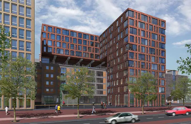
Oostelijke Handelskade, De Pakhuysen building, Eastern Docklands architecture image, IJ Holland architect
Oostelijke Handelskade Amsterdam
Eastern Docklands Building: Dutch Architecture design by KCAP Architects, The Netherlands
post updated 27 April 2024
Design: KCAP Architects

picture from architect practice
Oostelijke Handelskade
8 Feb 2008
Oostelijke Handelskade Amsterdam Building
A former docks area along the banks of Amsterdam’s IJ waterway is being transformed into a high-density residential and business area.
On the site known as De Pakhuysen (‘The Warehouses’), old warehouses and new blocks form a differentiated complex of interlocking buildings that preserve the views through to the IJ.
The buildings stand on a shared base containing a car park, and the entrances are set along a narrow, oblong public space. As well as drawing up the urban development plan, KCAP designed the car park and two of the four sculptural blocks.
Oostelijke Handelskade Amsterdam image / information from KCAP Architects
Location: Eastern Docklands, Amsterdam, The Netherlands, northern Europe
Architecture in Amsterdam
Contemporary Architecture in The Netherlands
Amsterdam Architecture Designs – chronological list
Adjacent building : Muziekgebouw
Amsterdam Architecture – contemporary building information
Amsterdam Buildings – historic building information
Amsterdam Walking Tours – bespoke Dutch city walks by e-architect
Zaanstad Sports Centre
Design: UArchitects
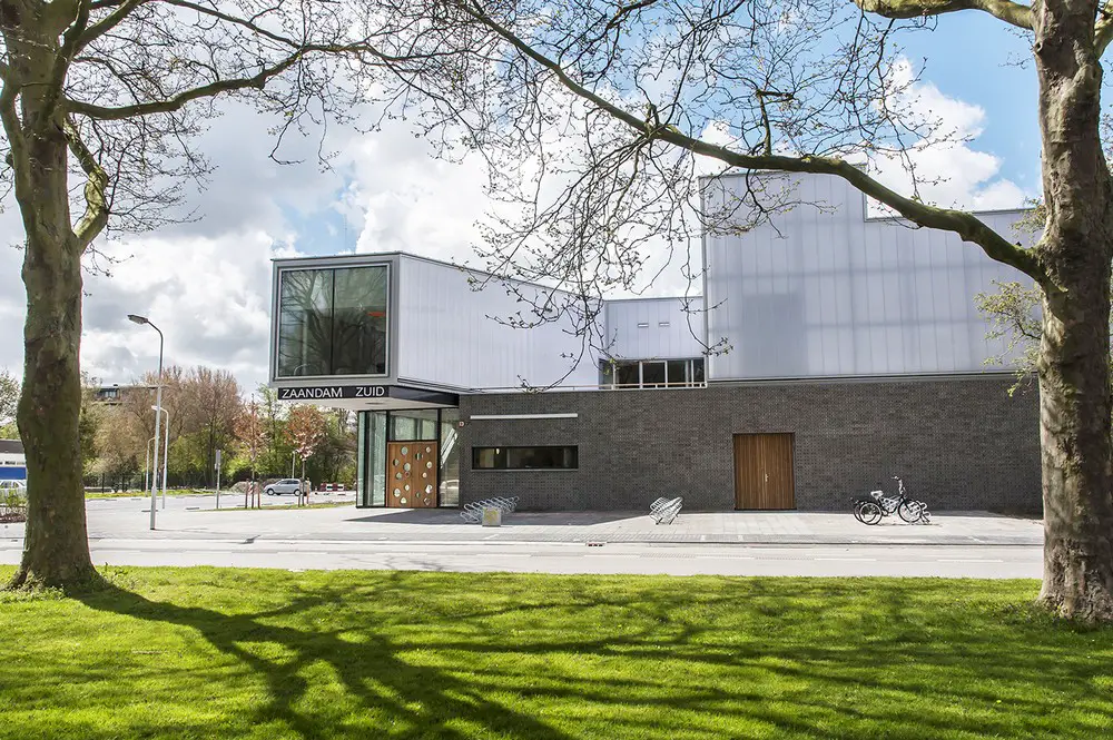
photograph : Daan Dijkmeijer
Zaanstad Sports Centre
Restaurant Felix
Design: i29 interior architects
Restaurant Felix Interior
The Eastern Docklands is a neighborhood of Amsterdam, Netherlands, located between the IJ and the Amsterdam–Rhine Canal in the borough of Amsterdam-Oost. The harbor area was constructed in the late nineteenth century to allow for increasing trade with the Dutch East Indies; a new location was necessitated by the construction of the Amsterdam Centraal railway station, which replaced the old quays.
East of the new station was a marshy area called De Rietlanden, with the Zeeburgerdijk (then called Sint Antoniesdijk), running via the Zeeburch, a fort, to the Zuiderzee. source: wikipedia
Dutch Architectural Designs
Major New Dutch Buildings
Netherlands Architecture Designs – chronological list
Comments / photos for the Oostelijke Handelskade Building – De Pakhuysen design by KCAP Architects in Amsterdam, The Netherlands page welcome.